

Cami de Ronda Costa Brava: 7 Best Sections to Walk

☕ Reader-supported. Every guide is free to read, with no sponsored recommendations. If Isle Passport helps you plan better trips, you can help create the next guide.
Let’s clear up the biggest lie about the Cami de Ronda Costa Brava right away: it is not one single, continuous trail. That is exactly why every article you read gives it a different length, ranging from 43km to over 200km. If you are trying to plan a trip, this is exhausting.
I walked sections of this trail across two trips, once from a base in Calella de Palafrugell with a rental car and once out of Tossa de Mar with nothing but a bus timetable.
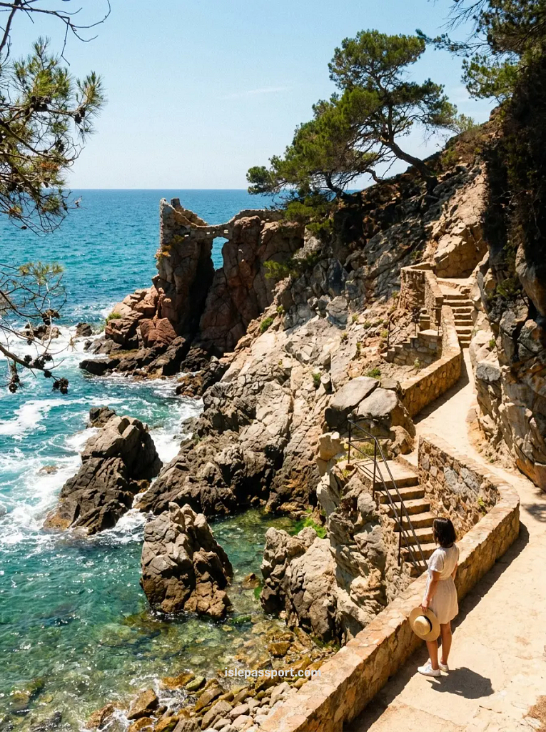
The honest truth? Almost nobody walks the entire coast, and you do not need to. What most people actually want is one good walk, near where they are staying, that they can easily finish and get back from.
Stop thinking of it as a thru-hike, and start thinking of it as a menu of stunning day walks.
Below are the seven sections actually worth your day, exactly how long they take, and how to get back.
And because half the reason to walk this path is that it drops you at water you cannot otherwise reach, I have written separately about the coves you cannot reach any other way.
In a rush? Here is the quick verdict:
The reality: The Camí de Ronda is a network of coastal paths, not one single trail.
Best for beginners: Sant Feliu de Guíxols to S’Agaró (one hour, flat, and paved).
Best scenery: Calella de Palafrugell to Llafranc (25 minutes between two stunning bays).
When to go: April to June or September to October. Skip August entirely.
Survival tip: Bring proper trail shoes for the steep sections. Do not attempt the whole thing in sandals.
How Long is the Cami de Ronda, Really?
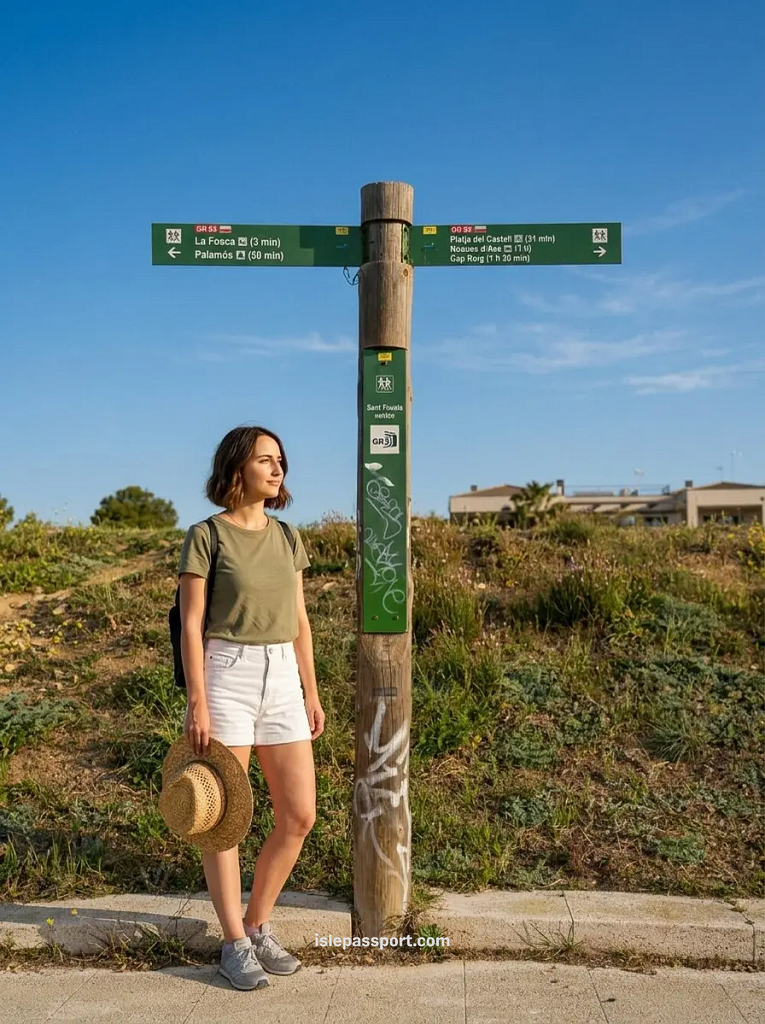
You will see 43km, 140km, 190km and more than 200km quoted online, sometimes in the same paragraph, and none of those numbers is exactly wrong.
Here is what is actually going on. Camí de Ronda is a generic Catalan name for the old coastguard watch paths that run along this shore. And there is a whole network of them, which is why locals say camins de ronda costa brava in the plural.
If you search in Spanish you will find the same thing written as camino de ronda costa brava; camí, camino and camins all point at the same paths.
The GR 92 is a different thing. It is a waymarked long-distance route homologated by the FEEC, the Catalan hiking federation, and it runs the entire Catalan coastline.
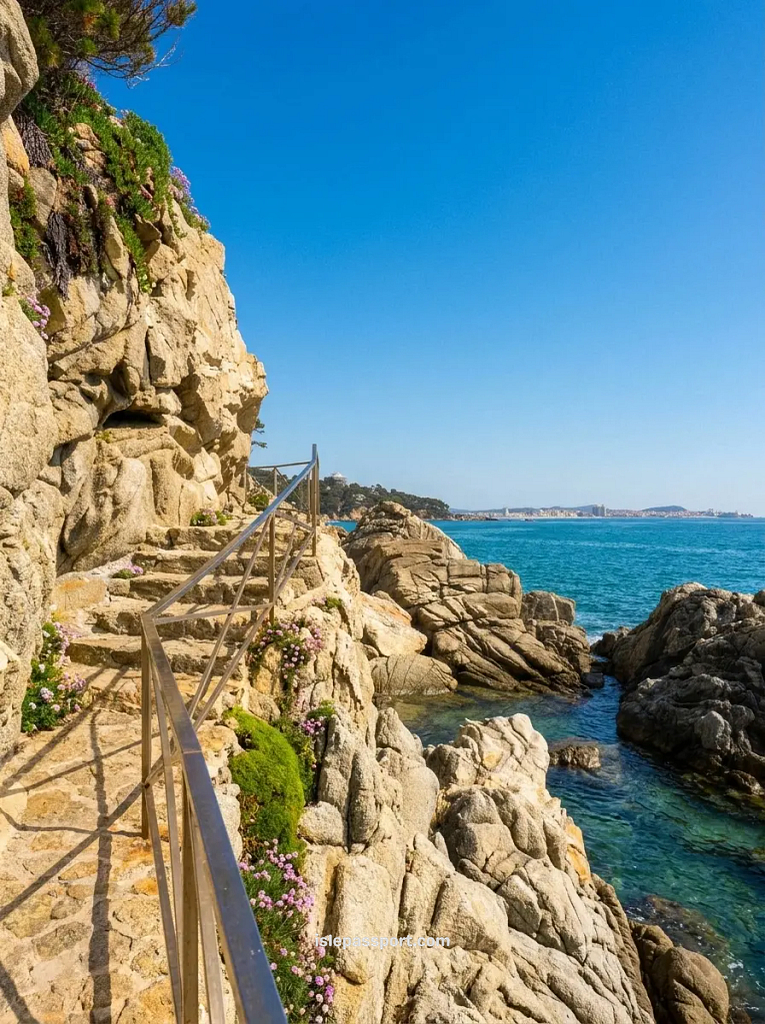
In places it follows the old coastal paths exactly. In others it cuts inland and the camí de ronda carries on alone along the cliffs.
The FEEC has also re-marked some shoreline stages that used to run inland, so even the official figure moves. That is the whole mystery solved. There is no single length because there is no single path.
What this means for you is simple, and it is the thing I wish someone had told me before my first trip. The sections below range from 25 minutes to about 3 hours, and one good one is a better day than three rushed ones.
Cami de Ronda Map and Sections
I kept looking for a decent cami de ronda mapa before my first trip and mostly found decorative squiggles, so here is the practical version.
The paths run in broken stretches from Blanes in the south to Portbou near the French border, and the seven sections below are the ones I would actually spend a day on.
🗺️ Best Camí de Ronda Sections Map
The seven walks I genuinely recommend, plus the best bases for reaching them. Colours show the difficulty at a glance.
If you want to walk more than one section, where you sleep quietly decides how much of this coast you can actually reach on foot.
I booked six nights in Calella de Palafrugell partly because two of the best sections start where the street ends, and I would do exactly the same again.
If you are trying to string three or four sections together across a week and the logistics are starting to feel like a puzzle, that is genuinely the kind of thing I help with.
I build custom day-by-day plans for this coast based on your base, your dates and how much walking you actually want to do. You can see how my trip planning works here.
The 7 Best Sections of the Cami de Ronda Costa Brava
1. Cami de Ronda Platja d’Aro & S’Agaró
The Essentials:
- Distance: 5km to Platja d’Aro, or 2km to S’Agaró.
- Time: 1 hour to S’Agaró and back.
- Surface: Paved and completely flat.
- Getting back: Walk or take the local bus.
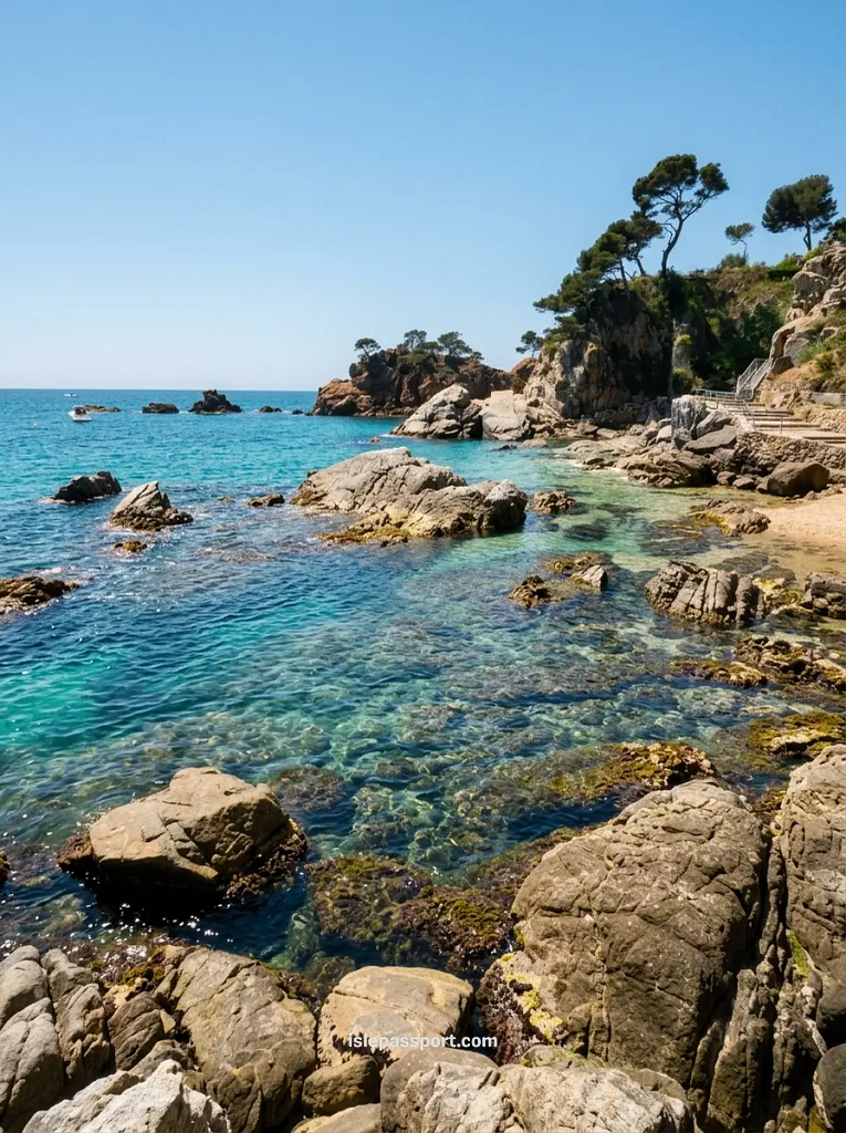
This stretch is the gentlest introduction this coast has. You leave Sant Feliu on a paved path that runs past the old 1920s mansions of S’Agaró. Through a couple of short tunnels cut into the rock, with the sea a few metres below you the whole way.
I walked it in the flattest sandals I own and it was completely fine. This is also the answer to the family question nobody else answers: it is flat enough for a pushchair, the whole way to S’Agaró.
The honest caveat: It is the least wild section on this list. You are walking past villas and manicured gardens, not empty cliffs.
If you want drama, this is not your section. If you want an easy hour with good views and a coffee at the end in Platja d’Aro, the Platja d’Aro side of this walk delivers exactly that.
Base yourself here: Sant Feliu or Platja d’Aro both work.
2. Cami de Ronda Llafranc & Calella de Palafrugell
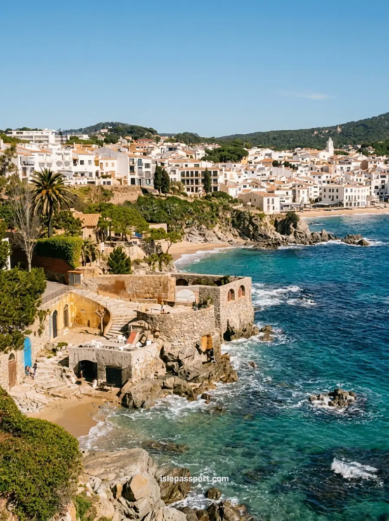
The Essentials:
- Distance: 1.5km.
- Time: 25 minutes.
- Surface: Paved path, completely flat.
- Getting back: Walk back, it is short.
If you only do one walk on this coast, do this one. This stretch took me about 25 minutes at a dawdle.
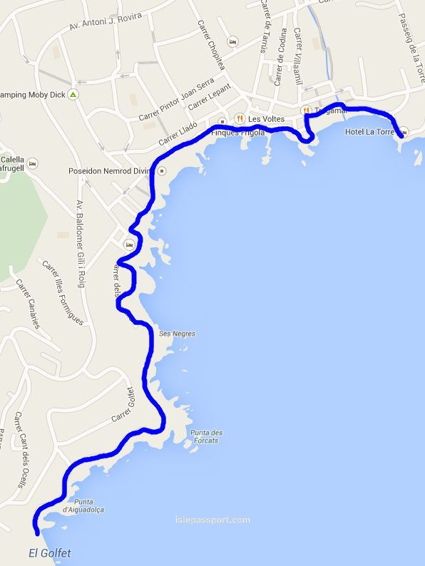
Hugging the rocks between two of the prettiest bays on the coast, and it is flat enough that I did it in sandals both times. I walked it before breakfast most mornings of my June stay, and at 8am I had it almost to myself.
The honest caveat: By 11am in summer it is a procession. This is the most photographed stretch of the whole network and everyone staying in either town walks it. Go early or go at sunset, not in between.
Base yourself here: Calella de Palafrugell, no contest. Two sections start where the street ends.
3. Cami de Ronda Tamariu from Llafranc
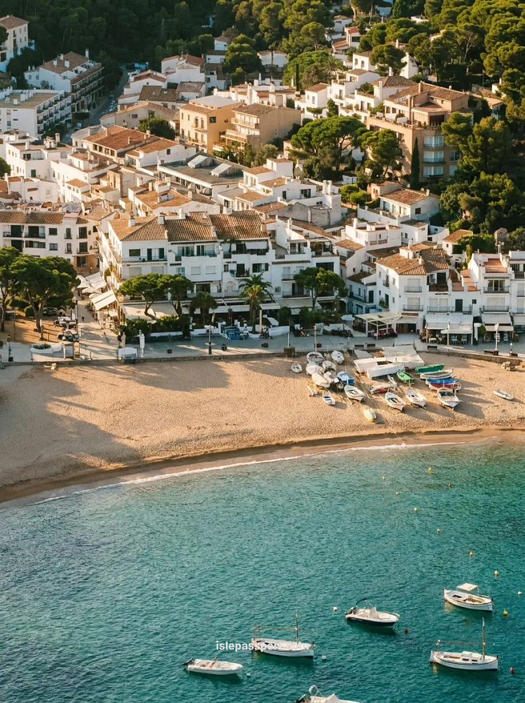
The Essentials:
- Distance: 4km via the Sant Sebastià lighthouse.
- Time: 1 hour 15 minutes.
- Surface: Stone steps and dirt, steep in places.
- Getting back: Walk back or take a taxi from Tamariu.
This is where the path shows its teeth. The climb out of Llafranc up to the lighthouse is a long flight of stone steps, and the descent toward Tamariu is steep dirt in places.
It is also the most beautiful section I walked anywhere on this coast. Pine forest right down to the water, and Tamariu at the end is a small bay that still feels like a village rather than a resort. Allow closer to an hour and a quarter than the hour most signs suggest.
The honest caveat: This is the section where people who assumed the whole path was a promenade turn around. I watched it happen on the steps above Llafranc, twice.
I walked the flat stretches of this coast in sandals and regretted it exactly once, right there, so wear proper shoes for this one. A basic pair of trail shoes is enough, you do not need boots.
Base yourself here: Llafranc or Calella de Palafrugell, and walk it from your door.
4. Cami de Ronda Begur: Sa Riera to Aiguablava
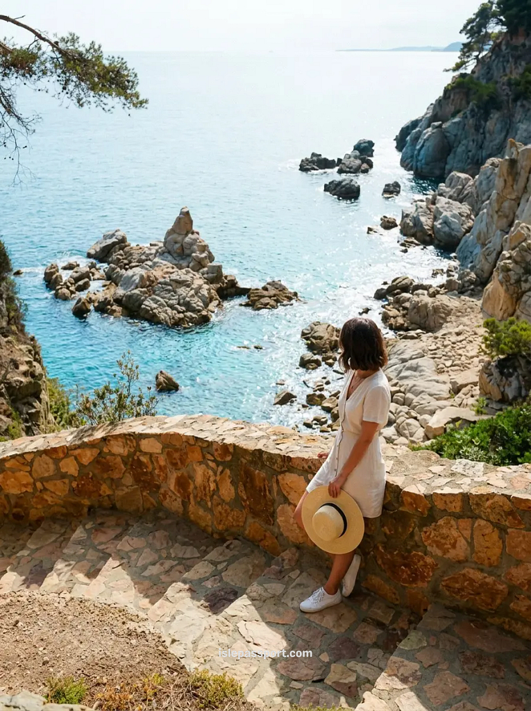
The Essentials:
- Distance: 5km via Sa Tuna.
- Time: 2 hours.
- Surface: Mixed, with steep stepped climbs between coves.
- Getting back: Taxi, or two cars if you are travelling as a group.
The Begur section strings together the coves below Begur town. From Sa Riera through Sa Tuna to Aiguablava, and the water colour along here is the best on the coast.
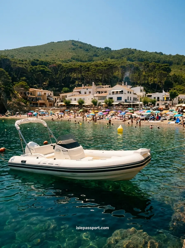
It is a proper walk, up and over headlands between each cove rather than along a level path, so 5km takes a genuine 2 hours.
The honest caveat: Parking is the real difficulty, not the walking.
The car park above Aiguablava was full before 10am when I tried in high season. And I ended up leaving the car up in Begur town and adding a downhill kilometre each way. Start early or start from the town.
Base yourself here: Begur town puts every trailhead within a few minutes’ drive.
5. Cami de Ronda Palamós to Calella
The Essentials:
- Distance: 8km.
- Time: 2.5 to 3 hours.
- Surface: Mixed, mostly good path with a few rough stretches.
- Getting back: Bus.
This section is the connector. The half day walk that links the working port of Palamós with the Palafrugell bays, passing a string of coves that only walkers and boats reach.
Some of the water below this path is honestly easier to reach from the sea than from the trail. And if that sounds better than walking, a kayak trip along this stretch runs from the beaches at either end for around €35 to €45 per person.
The honest caveat: There is a stretch north of Tamariu direction where the waymarks simply stop and the path appears to run through private villa land.
It does carry on, keep the sea on your right and trust the worn ground. But every walker hits that moment of doubt and no sign warns you. There is also almost no shade and no fountain for the middle hour, which matters a lot after noon in July.
Base yourself here: Either end works. Calella de Palafrugell is the nicer place to finish.
6. Cami de Ronda Tossa de Mar to Lloret
The Essentials:
- Distance: 10km.
- Time: 3 hours.
- Surface: Real trail with some road sections.
- Getting back: Bus (runs roughly every 30 minutes in season).
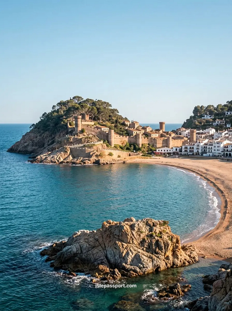
This section is the one I walked with no car at all. And it is the best choice if you are relying on buses. Because both ends are proper towns with regular connections.
You climb out of Tossa past the walled old town, and the first hour, looping over the headland past Cala Bona, is the best of it.
The honest caveat: The second half loses the coast in places and puts you on road. And Lloret is not a rewarding place to finish a beautiful walk.
My fix: walk the Tossa half out to the far coves, swim, and walk back. You keep the best scenery and skip the bus entirely.
Base yourself here: Tossa de Mar, the only genuinely pretty base on this list that works without a car.
7. Cami de Ronda Roses to Cap de Creus
The Essentials:
- Distance: 8km one way to the lighthouse.
- Time: 2 hours each way.
- Surface: Rocky, uneven, completely exposed.
- Getting back: Walk back the way you came.
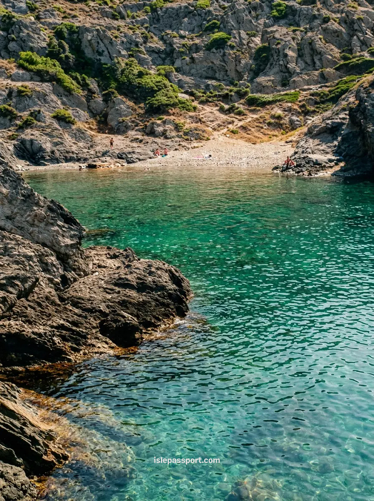
This is the wild end of the coast. The path out of Cadaqués toward the Roses side of the cape crosses a bare. Wind-carved landscape with not a single tree, out to the lighthouse at the easternmost point of mainland Spain.
I walked it from my base in Cadaqués and it felt like a different country from the pine coves further south.
The honest caveat: There is no shade at all, and the tramuntana wind turns a walk that looks easy on the map into a genuine slog.
When it blew during my stay, gusts were strong enough to make the exposed corners feel unsafe, and locals just do not walk it on those days.
Check the wind before you commit, carry more water than feels reasonable, and do not do this one in August heat.
Base yourself here: Cadaqués, five nights of my last trip, and I would give it five again.
Walking the Cami de Ronda Without a Car
Here is the honest hierarchy. The train reaches exactly one trailhead: Blanes, at the very southern tip of the coast, on the Rodalies line from Barcelona.
Everything else is buses. The Sarfa coaches run by Moventis connect the coastal towns and are what make one way walks possible.
I used them to get back to Tossa in May. And the thing to know is that the last departure came earlier than I expected, at 8.40pm, with nothing after it. Check the day’s timetable before you start walking, not when you finish.
The car-free shortlist, in order: Tossa de Mar for the best trail access. Calella de Palafrugell if you can handle one bus connection from Girona or Palafrugell town.
And Blanes if you insist on rail. Cadaqués has a bus from Figueres but it is a long, winding ride, so I would only do it for a multi-night stay, never a day trip.
Getting There and Where to Start

If you are based in Barcelona, the train reaches this coast but stops well short of the best walking. And I have mapped what you can actually get to by rail in a separate post about day trips from Barcelona. The short version is Blanes and a bus onward, or an early Sarfa coach direct to Palafrugell or Tossa.
For everything north of Tossa, a car changes the trip. A car makes the northern sections reachable. Though it also creates the problem of getting back to where you left it.
Which is why I planned loops and out-and-backs rather than one-way walks on the driving days.
I use Discover Cars for Spain because it surfaces the local Girona operators alongside the chains. And local came in about €12 a day cheaper for the same class of car on my June trip.

The path also connects towns worth stopping in for their own sake, and I have been honest about which ones earn the detour in my guide to the best coastal towns on the Costa Brava. Because they are not all equal.
Official stage descriptions and any current path closures are published by the Costa Brava Tourist Board, and it is worth a two minute check before a walking day, because storm damage does close short stretches.
Where to Base Yourself for the Cami de Ronda
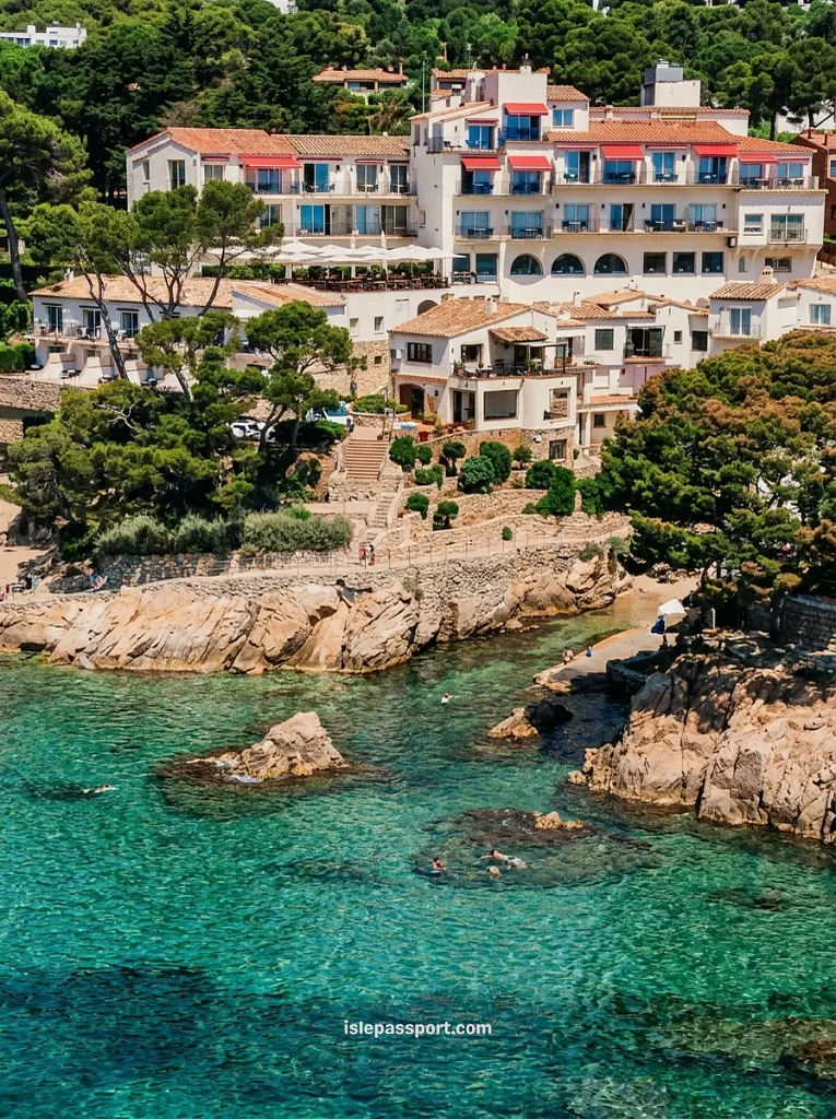
Where you sleep quietly dictates how much of this coast you can actually walk. But here’s the thing.. You do not need to haul a heavy backpack from hotel to hotel every night. That’s a nightmare on these steep steps.
The smart play is picking one solid base camp. Or splitting your week between two, and doing day walks right from your front door.
Having done this coast both with a rental car and relying entirely on local buses, here are the four bases that actually make sense for walking, along with the exact places I would book:
If you want the best overall location, stay in Calella de Palafrugell at Hotel Sant Roc. It sits right on the cliff with steps leading straight down to the coastal path.
Some of the historic rooms are on the smaller side, but they have private parking on-site. And trust me, finding parking in Calella during summer is practically a miracle.
If you don’t have a car, book Hotel Diana in Tossa de Mar. It’s a gorgeous old Catalan Modernisme building right on the beach promenade.
About five minutes on foot from the main bus station where you’ll catch your rides back. Just don’t bring a car here. It has zero on-site parking, so it only makes sense if you arrive by bus.
For quiet coves, head just outside Begur town to Hostal Sa Rascassa. It’s a tiny, peaceful spot with just five rooms hidden under the pines at Cala d’Aiguafreda.
Literally steps from the water and the path. Their shaded seafood restaurant gets buzzy at dinner time. And because there are only five rooms, you have to book this one months in advance.
If you are heading up to the wild northern cape, stay at Hotel Playa Sol in Cadaqués.
Driving inside Cadaqués is notoriously tight and stressful. But this place sits right on the bay and has its own private garage, which completely solves the parking headache before you set off for Cap de Creus.
Best Time to Walk the Cami de Ronda
April to June and September to October, and it is not close. In those windows you get walking temperatures, open restaurants and space on the path.
August is the wrong answer twice over: the heat on the shadeless stretches is genuinely punishing between noon and four, and the paths near the towns are as crowded as the beaches.
Winter walking is possible and often beautiful in the south, but the tramuntana rules the northern cape, and when it blows the Cap de Creus section is off the table completely.
Questions I Get Asked About the Cami de Ronda
How long is the Cami de Ronda hike if I just want one day?
Plan for two to three hours of actual walking and you will fit any section on this list except the full Tossa to Lloret stretch. A cami de ronda hike is a morning, not an expedition. My ideal day was walk from 8 to 11, swim, long lunch, and the bus or a slow walk back.
Can you walk the Cami de Ronda with kids?
Yes, if you pick the right section. Sant Feliu to S’Agaró is flat, paved and pushchair friendly the whole way. And Calella to Llafranc works for any child who can walk 25 minutes. I would not take young kids on the Llafranc to Tamariu steps or anywhere near Cap de Creus.
Do you need hiking boots?
No. I did the whole coast in a mix of sandals and light trail shoes. The only stretches where footwear mattered were the steps above Llafranc and the rocky ground near the cape, and trail shoes handled both. Boots would be overkill in the heat.
Can you swim along the way?
Constantly, and it is the whole point. Nearly every section drops to at least one cove. So I walked in swimwear with a towel in the bag and stopped whenever the water looked good, which was most of the time. The one exception is the outer Cap de Creus stretch, where entry off the rocks is awkward and the wind can make the sea rough.
Is the path waymarked the whole way?
Mostly, and then suddenly not. The busy sections near towns are signed well. But there are moments, like the villa stretch I mentioned north of Tamariu. Where markers vanish for a few hundred metres. The rule that never failed me: keep the sea beside you and follow the worn ground.
What is the most famous hiking trail in Spain?
The Camino de Santiago, by a mile, but they are not comparable. The Camino is weeks of inland walking with a destination. The camins de ronda are short coastal walks with a swim in the middle. I love that you can do the best of this coast in a long weekend without any of the pilgrimage logistics.
Is the Costa Brava good for cycling, and what is the nicest town?
Cycling yes, but inland. The coastal path itself is for feet, with steps and narrow rock cuttings that no bike should be on. While the quiet roads behind the coast are full of road cyclists in spring.
As for the nicest town, I have ranked them honestly elsewhere. And I will only say here that my money went to Calella de Palafrugell and Cadaqués.
Final Thoughts on Walking the Cami de Ronda
The camí de ronda is the best thing on the Costa Brava. Better than any single beach or town. Because it is the thing that makes all the beaches and towns make sense together.
My honest criticism is that the region undersells it. Signage is inconsistent, the official information is scattered across half a dozen websites.
And nobody in charge seems to have decided whether it is one path or many. Which is exactly why every article quotes a different length. Ignore all of that.
Pick one section from the seven above, go before 9am, put a towel in your bag, and walk until you find water you like.
That morning on the path between Calella and Llafranc, before the crowds, with the sea flat and nobody swimming yet, is still the clearest memory I have of two trips to this coast.
Check out my other Costa Brava and Spain posts:
- Best coastal towns on the Costa Brava: The five that actually earn your time, ranked honestly.
- Best beaches on the Costa Brava: The hidden coves you can only reach on foot or by boat.
- Best beaches in Spain: 25 spots with genuinely clear water, mapped.
- Prettiest coastal towns in Spain: The 14 best options, complete with an interactive map.
- Car-free Spanish coastal towns: How to reach and enjoy the coast without renting a car.
- Off-season Spain destinations: Quiet beach towns that actually work in spring and autumn.
- Spain coastal travel guide: My full collection of posts in one place.
Before You Book: The Tools I Actually Use
I only link to tools and platforms I’ve personally used and would use again. If you book through my links I earn a small commission at no extra cost to you — which helps me keep writing these guides.
Sort by guest rating above 8.5 and check the map view before confirming.
Book as soon as you confirm flights. Summer prices in the islands rise fast.
Routes sell out in July and August. Book early for Balearic islands.
Boat tours, kayaking, guided hikes. Morning slots go first.
I never travel without it — covers illness, cancellations, and lost luggage.
The easiest way to move between coastal towns without a car. Prices rise closer to departure.
💛 Loved this guide?
If it helped you plan your trip or discover somewhere new, you can help me create the next one. Every guide is free to read, independently researched, and made with travellers like you in mind.
